|
|
New Jersey
Download all NJ factsheets |
|
Atlantic County
View map | Factsheet |
Middlesex County
View map | Factsheet |
Brooklyn
View map | Factsheet |
Bergen County
View map | Factsheet |
Monmouth County
View map | Factsheet |
Manhattan
View map | Factsheet |
Burlington County
View map | Factsheet |
Morris County
View map | Factsheet |
Queens
View map | Factsheet |
Camden County
View map | Factsheet |
Ocean County
View map | Factsheet |
Staten Island
View map | Factsheet |
Cape May County
View map |
Passaic County
View map | Factsheet |
Nassau County
View map | Factsheet |
Cumberland County
View map |
Salem County
View map |
Suffolk County
View map | Factsheet |
Essex County
View map | Factsheet |
Somerset County
View map | Factsheet |
Dutchess County
View map |
Gloucester County
View map | Factsheet |
Union County
View map | Factsheet |
Orange County
View map | Factsheet |
Hudson County
View map | Factsheet |
Warren County
View map |
Putnam County
View map |
Hunterdon County
View map |
|
Rockland County
View map |
Mercer County
View map | Factsheet |
|
Westchester County
View map | Factsheet |
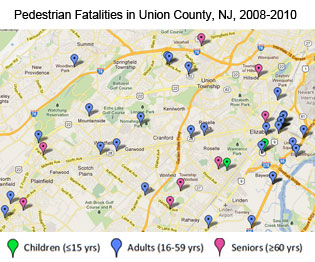 This analysis identifies the most dangerous roads in the tri-state region for pedestrian fatalities. Looking at federal data from 2008 to 2010, it includes factsheets and online maps that identify the locations of pedestrian fatalities and the age and gender of those killed. Counties in downstate New York and New Jersey that had 10 or more pedestrian fatalities over the three-year period were analyzed, as was the state of Connecticut.